
Check out the latest Spectra Geospatial news.
Smartphone GNSS data collecting just got brighter, faster and easier. The rugged MobileMapper® 60 offers superior durability, efficiency and accuracy…...
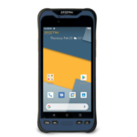
Westminster, Colo., April 12, 2022—Spectra Geospatial introduced today the Spectra Geospatial® ST100 tablet—a rugged, hard working mobile device with a…...

The go-to suite of solutions for a family of surveyors Three generations of Wisconsin surveyors choose Spectra Geospatial® for their…...
WESTMINSTER, Colo., Nov. 5, 2021—Spectra Geospatial introduced today the Spectra Geospatial FOCUS 50, a new range of robotic total stations…...

Cincinnati, Ohio, October 2021 – Spectra Geospatial and Precision Laser & Instrument (PLI), a Spectra Geospatial Authorized Distribution Partner, have…...
Westminster, Colo., June 8, 2021—Spectra Geospatial introduced today the Spectra® Geospatial Origin software and the new Ranger 5 Data Collector,…...

Le Tampon, La Réunion, (February 2021) – Piton de la Fournaise (Peak of the Furnace), one of the world’s most…...

Nantes, France (February 2021) – A Spectra Geospatial SP90m GNSS receiver provided the precise position and boat heading information for…...

Athens, Greece (January 2021) – A two-person Astrolabe Engineering survey team using a single SP60 GNSS receiver recently completed the…...

Worcester, UK (January 2021) — The Survey School has received three Spectra Geospatial SP85 GNSS receivers with Ranger 7 data…...

The Spectra Geospatial® ADL450B is an advanced, high speed, wireless UHF data radio designed to connect via Bluetooth® to Spectra…...

Nairobi, Kenya (October 6th, 2020) – The Mau Forest Complex in the Rift Valley in Kenya is the largest indigenous…...

Nantes, France (September 14th, 2020) — The Spectra Geospatial SP90m GNSS receiver has been selected by the racing yacht Maître…...
Aplitop Tcp Tunnel Software Now Works with Spectra Geospatial Focus 35 Total Station This collaboration provides surveyors and geospatial professionals…...

Ambridge, PA; March 2020, Spectra Geospatial and Precision Laser & Instrument (PLI), a Spectra Geospatial dealer in Western Pennsylvania, West…...

Trimble technology produces cost saving and high accuracy results using Spectra Geospatial SP60 GNSS in combination with Trimble CenterPoint RTX…...

Yorkshire, UK, October 2019 – Verified photomontage is an important planning tool to envision how proposed surrounding development plans would…...
Watch interview with Joe Sass presenting the latest Spectra Geospatial product releases: FOCUS 35 robotic total station, available in three…...
East Meets West Meets East by Gavin Schrock, PLS, XYHT. October 2019 Read latest FOCUS 35 detailed article about the…...
STUTTGART, Germany, Sept. 17, 2019—Spectra Geospatial introduced today new and enhanced products to its Spectra Geospatial and Nikon portfolio of…...

Nantes, December 2018 – Congratulations to Nandor M., the winner of our Intergeo 2018 contest! Nandor, one of the founding…...
Spectra Precision announced the launch of a new brand identity and name for its survey and GIS suite of solutions.…...

The SP20 provides state-of-the-art, high performance GNSS capabilities in a handheld form factor. Rugged, lightweight and scalable, the SP20 offers…...

The Spectra Precision SP60 GNSS receiver has been selected to perform survey work for construction of a new 450-kilometer electric…...

FOCUS 35 Total Station with Auto Scan Helping Build China’s Expressway Network Spectra Precision FOCUS 35 robotic total stations are…...

The Nikon® N and K total stations offer an advanced EDM in an innovative package, including flexible charging and connectivity…...

The Nomad® 1050 rugged handheld computer’s many built-in capabilities make it an optimized and easy to use field data collector.…...

The Spectra Geospatial® ST100 is a hard working, no-nonsense tablet with a slim, rugged design and powerful features to handle…...

Nantes, November 2017 – Congratulations to Johannes Nensel, the winner of our Intergeo 2017 contest! Nensel, a student intern at…...

To increase interest and involvement of people in protecting and improving the Ribble River, the Ribble Rivers Trust recently commissioned…...

SAN DIEGO, Calif., June 28, 2016 — Spectra Precision announced today its new MobileMapper 50 GNSS handheld device for simple…...

The MobileMapper 300 smart antenna and DigiTerra Explorer v7, one of Europe’s leading GIS software solutions for mobile mapping, now…...

Spectra Precision introduced today the Spectra Precision® FOCUS DL-15 Digital Level. The DL-15 electronic height measurement yields accuracy and range…...

The Spectra Geospatial® MobileMapper® 6 data collector provides access to advanced accuracy for a wide range of professional handheld data…...

During this past Intergeo 2014 in Berlin, we had the pleasure to have Lisa Makelberge selected as the winner of…...

Ankara, November 21st, 2014 – The Geomatics Group, a leading Spectra Precision distributor and GIS software developer in Turkey, is…...

Saskatchewan, Canada, (November 21st, 2014) – Across the vast remote prairies and boreal forests of Saskatchewan lie numerous bridges, large…...

Bosnia and Herzegovina is burdened with one of the world’s most severe land mine problems as a result of the…...

The Spectra Precision FOCUS 35 is a new range of motorized total stations providing high speed, accuracy and precision in…...

LAS VEGAS, Nov. 3, 2014—Spectra Precision introduced today a new high-accuracy solution for its Geographic Information System (GIS) portfolio—-the MobileMapper®…...

Spectra Precision introduced a new cloud computing service for Spectra Precsion applications. The company also announced new road modules for…...

Berlin, Oct. 7, 2014—Spectra Precision introduced today new and enhanced products to its Spectra Precision® FOCUS® line of optical survey…...

TERRAIN is a very young and fresh cartographic and publishing company in Greece. Fotis Reppas, Chief Cartographer of TERRAIN, talks…...

Burying utility cables under the seabed in shallow water environments to ensure cable safety is accelerating because of green power…...

Geographical Information Systems and Location Based Services are strongly penetrating a wide range of applications and organizations. Ashtech® is leading…...

By Matthew Simon Matthew Simon, UNC Center for Public Health Preparedness, GIS Analyst & Research Associate GIS technology is offering…...

Ashtech invests heavily in the development of cutting edge technology to further strengthen its position as a leading designer and…...

François Erceau Interview focusing on the new ProMark products...

Read the full article on www.Geoinformatics.com Geomatics Ltd is a Turkish company that specializes in land surveying by optical and…...

François Erceau Interview focusing on the MobileMapper 100 Link to video...

Ashtech is one of oldest and most respected brands in the GNSS industry. Recently spun off from Magellan, Ashtech is…...

They’re back! While the name Ashtech may sound new to younger folks in the precise community, its corporate predecessors, Ashtech,…...
- Spectra Geospatial Partners
- Nikon Partners
PARTNERS